
8/26/2019

At 0900 we checked out at the visitor’s center and left Hattie Cove fondly in the rear view mirror.

Curving around the National Park, the highway leaves the lake shore and runs through pine forest.

The cub inspired the AA Milne stories which inspired this very detailed chainsaw art depicting Lieutenant Coleburn with Winnie.

Lots of Pooh items can be found here, including this handsome handmade quilt.

Further down the road and getting a little hungry at noon, we pulled over to observe a giant Canada Goose in the town of Wawa.

An informational plaque has some good data on places to stop on this stretch of highway as it rejoins the eastern shore of Lake Superior.

Local artisians display some of their wares at the Wawa Visitor’s Center. This chair would be perfect for a Lake Superior cabin.

Carved logs added interest to our quick walk around Wawa.

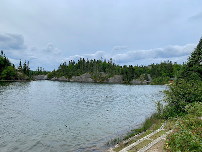
Despite gray skies and rain, the Algoma scenery was beautiful, as advertised.

With the highway running along the lakeshore, we took advantage of the Agawa Bay Overlook.

Pines contrast the grey granite rocks that make up the shoreline here.

Chippewa Falls were just off the highway. They were pretty, but weren’t up to the size and flow of other falls along the circle route.

While I think of Ontario as being eastern Canada, the Chippewa River here marks the 1/2 way point on the Trans-Canada Highway.

Another artist’s point of view was memorialized overlooking the river and falls. A few trees have grown up since the scene was originally captured with brushes and oils.

A rainy afternoon compelled us to continue on to the international border in Sault Ste. Marie. The towns on both sides of the Saint Mary’s River here bear the same name.

Waiting for our turn at customs, we could see a lake freighter passing underneath us. There were no issues at the border and we descended into the US town of Sault Ste Marie looking for a spot to spend the night. Allstays showed an inexpensive ($20) camping option at Sherman Park. An older campground, it had aging restrooms and a small beach that we wouldn’t be using on a rainy, windy day. After pulling into a site, we learned that there was no Verizon cell signal, so decided to investigate another option.

Driving east, past the border bridge again, we came to Aune Osborn Campground. Basically an open field with RV sites, the attraction is a great view of maritime commerce on the St Marys river.

The campground also has modern showers, laundry facilities, and a dump station for $30 per night. The office and all facilities coexist in this one building.

Though we didn’t have a front row waterfront site, freighters are big enough that we could see them coming over neighboring RV’s. When it wasn’t raining hard, I walked down to the riverside to watch and listen to the big ships working their way between the Great Lakes.

Lake freighters can be long. Watching this one head towards Lake Superior made me think of the Edmund Fitzgerald breaking in half when suspended between two large waves.

The Saint Marys river channel is just wide enough for two big ore carriers to pass. Water flows east and then south from Lake Superior to the North Channel of Lake Huron.

The Saginaw had a self loading crane on deck. Southbound ships, like this one, get a 2 mph speed boost from the current.

As evening fell, and we slipped under our quilt, we could hear the big diesel engines and peek out our window to see the lights of freighters moving on the river.

Overview Map – 277 miles over 8 hours

Sault Ste Marie Map
Leave a Reply