
30 July 2022 – Saturday

The consolation prize was having an easy walk to Jacob’s Falls all to ourselves.

0910 48,054 Great Sand Bay Park

Open to the full force of Lake Superior, the horizon looks like an ocean view. A freighter was headed west, towards Duluth, as we gazed out over the inland sea.

0929 48,057 Eagle Harbor Lighthouse

While the US Coast Guard maintains the light, the building is run as a museum by the Keweenaw County Historical Society. Check their web site for tour dates and hours. The grounds are open even when the buildings are not.

Eagle Harbor is the midpoint of Lake Superior’s southern shoreline.

1020 48,059 Eagle Harbor Life Saving Station.

The Life Saving Station grounds have lots of free parking and offer great views of the Eagle River Light House.

Four miles outside of Eagle River, we stopped at Silver River Falls. Pretty cascades were an easy walk from the road.

1132 48,072 Copper Harbor State Marina

Homes enjoy lake views, and protected dockage adjacent to the State Harbor.

1149 48,075 Fort Wilkins State Park –

Built in 1844, the military buildings face a common green.

Historical actors provide living history, answering questions about life in the mid-1800’s.

All the buildings used the same log construction with these interesting corner joints.

The “commercial” area stood outside the fort walls housing traders and craftsmen.

Across the stone beach from Fort Wilkens, Copper Harbor light can be seen protecting the harbor entrance.

Built in 1848, the lighthouse is no longer in use. The actual light was automated and moved to the adjacent 62 foot tall white steel tower in 1933.

Noticed a pick-up truck with a bed camper on our way back to the van. The unit is made by Go Fast Campers.

1356 48,078 Beginning of Route 41

1440 48,085 Manganese Falls

1516 48,105 Mendota Lighthouse

Pleasure boats were traversing the channel heading for the well-protected Lac Labelle State Harbor.

Just north on the Lake Superior shoreline, swimmers and sunbathers were enjoying the public beach at Gris Bay.

1627 48,131 Gay, MI

The Gay Bar (the only bar in Gay) advertises food, drink, wi-fi, and ice cream. We didn’t check to see if the parking meters were decorative or functional.

Headed back towards Eagle River, on Route 41, we stopped at this huge snow gauge. The red arrow shows last winter was above average at twenty-seven feet. The record set during the winter of 1978-79 is 3,904 inches. Beth survived driving her Chevy Vega up here for a visit one winter a long time ago.

1700 48,153 Eagle River

Just down the road, Eagle River history is accessible at the Houghton Township Museum.

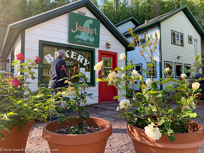
Almost full circle, we passed Holy Protection Monastery where the baking Monks that run the Jampot live and worship. Hidden from the road by trees, the monastery borders the Lake Superior shoreline.

1800 48,164 65° Eagle River Lakefront

We checked the restaurant at Fitzgerald’s Inn for dinner, but should have made reservations on a Saturday in July. Only a little disappointed, we made dinner in the van while watching freighters passing offshore.

1919 48,165 Back at Smokin’ Soul

(click on map to enlarge)
Leave a Reply